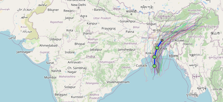
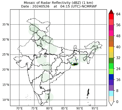
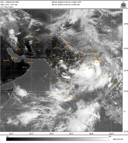
Cyclone Remal is predicted to form in the Bay of Bengal and affect regions between Sagar Island in West Bengal and Khepupara in Bangladesh by Sunday midnight, according to a warning issued by the India Meteorological Department (IMD) on Friday.

Table of Contents
Cyclone Remal Development and Path
Friday: Cyclone Remal is expected to intensify into a cyclonic storm by Saturday morning and develop into a very strong cyclonic storm by Saturday evening, according to IMD’s forecast.
Sunday Midnight: As a strong cyclonic storm, the cyclone is expected to traverse the shores between Sagar Island and Khepupara.
Anticipated Effect
Wind Speeds: On Sunday, Cyclone Remal may reach wind speeds of up to 120 km/h.
Heavy Rainfall: On May 26–27, extremely heavy rainfall is predicted in the coastal districts of northern Odisha and West Bengal; on May 27–28, extremely heavy rainfall is predicted in some areas of northeast India.
Potential Damage: Localised flooding and significant damage to susceptible structures, power and communication lines, crops, and orchards are possible in West Bengal’s South and North 24 Parganas districts.

Preventive Actions
When Inside:
- Keep track of the weather and IMD alerts.
- To avoid electrical fires, turn off the main power source.
- Cut the gas supply off to prevent leakage.
- Because of possible contamination, boil or filter water before using it.
- To prevent damage from severe winds, shut doors and windows firmly.
- If your structure is under risk, relocate to a more secure location.
While Outside:
- Find a secure covered structure to take cover in.
- Steer clear of weak constructions.
- Avoid areas with infrastructure that supply electricity.
- Steer clear of water, sharp things, and cables.
After the Cyclone:
- Before departing a safe location, wait for official confirmation that the risk has passed.
- Make sure it’s safe to leave the area before entering any buildings.
- Steer clear of wires, electrical equipment, and possibly contaminated things.
- Take quick action to maintain cleanliness to stop the spread of vector- and water-borne illnesses.
Cyclone Naming
Cyclone Remal has been named using the Indian Ocean region naming method. It is the first cyclone of the pre-monsoon season in the Bay of Bengal.
Notice to Fishermen
It is recommended that fishermen who have already sailed return to land and avoid entering the Bay of Bengal until May 27.

Climate Prediction
According to Monica Sharma, an IMD scientist, the low-pressure region in the Bay of Bengal is expected to intensify into a cyclone by Saturday morning and make landfall on the Bengali shores by Sunday evening. On Sunday, the storm is expected to attain wind speeds of up to 102 km/h.
Climate Background
Scientists have observed that cyclones are growing stronger and holding their intensity for extended periods of time as a result of rising sea surface temperatures. Since records first started in 1880, this year’s sea surface temperature is the highest it has been in thirty years.
Conditions of Heat and Rainfall
Heat: Extreme heat is being felt throughout a large portion of India.
Rainfall: There has been a lot of rain in Kerala.

Election-Related Impact
West Bengal’s sixth phase of the Lok Sabha elections is set to begin voting on Saturday. Cyclone Remal might interfere with the election.
Weather Predictions
Wind Speeds: On May 25, IMD predicts wind speeds of up to 100 km/h in Bangladesh and 80 to 100 km/h in some West Bengal districts.
High Rainfall: On May 26–27, extremely high rainfall is predicted in the coastal regions of West Bengal, North Odisha, Mizoram, Tripura, and South Manipur.
Storm Development: On Saturday, May 25, the storm is expected to strengthen into a deep depression; on May 26, it is expected to become a severe cyclonic storm.
Uncertainty Near Landfall
It won’t be possible to determine the precise location of the cyclone’s landfall until the storm has completely developed. International meteorological models indicate that Remal might land anywhere from the Bangladeshi Sundarbans to the Odishan coastline; however, accurate information will only be available from the IMD a few hours prior to landfall.
Parallels with Hurricane Amphan
Cyclone Amphan, which devastated Kolkata in 2020, is thought to have had a similar path as Cyclone Remal, according to some meteorologists. At 2:30 PM, Cyclone Amphan made landfall in West Bengal near Digha, with winds of about 190 km/h. By 3 PM, the storm had passed through Kolkata, with winds of about 110 km/h.
Read Also: IMD Alerts to emphasize readiness and knowledge of the meteorological conditions in Northern India


